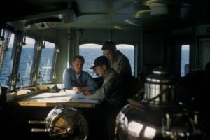
Automatic Radar Plotting Aid (ARPA): Enhancing Maritime Navigation
- Posted by MCC
- Date 29/08/2023
- Comments 3 comments

Navigating Waters Safely with Automatic Radar Plotting Aid (ARPA)
Introduction
Navigating the vast expanse of the ocean has always been a challenging task. Ensuring the safety of vessels, passengers, and crew members requires advanced technologies that provide accurate information about the surrounding environment. This is where the Automatic Radar Plotting Aid (ARPA) comes into play. ARPA is a vital tool that enhances maritime navigation by providing real-time data and insights to seafarers. In this article, we’ll delve into the intricacies of ARPA, its significance, benefits, and how it contributes to safe navigation on the high seas.
Automatic Radar Plotting Aid (ARPA): A Comprehensive Overview
Automatic Radar Plotting Aid (ARPA) is a sophisticated technology that has transformed the way vessels navigate through water bodies. It is an advanced radar system that assists seafarers in making informed decisions by accurately tracking and predicting the movement of nearby vessels and obstacles. ARPA leverages radar data and advanced algorithms to calculate the projected paths of vessels, allowing navigators to anticipate potential collisions and take timely evasive actions.
The Evolution of ARPA Technology
Over the years, ARPA technology has evolved significantly. From its inception as a simple collision avoidance system, it has grown into a comprehensive tool that offers a range of functionalities. Modern ARPA systems integrate multiple sensors, such as GPS and AIS (Automatic Identification System), to provide a holistic view of the vessel’s surroundings. This evolution has made ARPA an indispensable component of maritime navigation, ensuring safe and efficient passage for ships of all sizes.
Benefits of Using ARPA
- Collision Avoidance: The primary benefit of ARPA is its ability to prevent collisions at sea. By calculating the trajectories of other vessels, ARPA assists navigators in identifying potential collision courses and taking preemptive actions to avoid accidents.
- Enhanced Situational Awareness: ARPA provides seafarers with real-time data about the positions, courses, and speeds of nearby vessels. This information enhances situational awareness, allowing for better decision-making even in challenging weather conditions.
- Efficient Route Planning: ARPA enables navigators to plan more efficient routes by analyzing the movement of vessels around them. This not only saves time but also optimizes fuel consumption and reduces the environmental impact of maritime travel.
- Maneuvering Assistance: When navigating congested waters or entering busy ports, ARPA assists in executing precise maneuvers. It suggests the best course of action to avoid obstacles and facilitates safe entry and exit from harbors.
How ARPA Works
ARPA operates by processing radar data and performing complex calculations to predict the future positions of vessels within its range. The system takes into account factors such as vessel speed, course, and acceleration. By continuously updating this information, ARPA provides navigators with a dynamic and accurate representation of the maritime traffic around them.
Utilizing ARPA: Best Practices
To fully harness the capabilities of ARPA, seafarers should adhere to the following best practices:
- Regular Calibration: Calibrate ARPA regularly to ensure the accuracy of the data it provides.
- Interpretation: Understand the information displayed on the ARPA screen and interpret it correctly.
- Redundancy: Despite the sophistication of ARPA, it’s crucial to maintain a watchful eye on the surroundings and have a backup plan in case of system failure.
FAQs about ARPA
Q: How does ARPA differ from traditional radar systems?
A: Unlike traditional radar, ARPA offers advanced features such as target tracking, collision prediction, and efficient route planning, making it a comprehensive tool for modern maritime navigation.
Q: Is ARPA suitable for all types of vessels?
A: Yes, ARPA can be utilized on various vessels, including cargo ships, cruise liners, and fishing boats, to enhance safety and navigation.
Q: Can ARPA operate effectively in adverse weather conditions?
A: Yes, ARPA is designed to function optimally in different weather conditions, providing crucial data to navigators even in challenging situations.
Q: How frequently should ARPA systems be updated?
A: ARPA systems should be updated according to the manufacturer’s recommendations, usually during regular maintenance schedules.
Q: Are there any legal requirements for using ARPA?
A: Many maritime regulations mandate the use of ARPA on certain vessels to ensure safe navigation and prevent collisions.
Q: Can ARPA replace human decision-making entirely?
A: While ARPA enhances decision-making, human judgment remains essential for assessing complex situations and adapting to unforeseen challenges.
Conclusion
Automatic Radar Plotting Aid (ARPA) has transformed the maritime industry by enhancing safety, efficiency, and situational awareness on the high seas. With its ability to predict vessel movements and assist navigators in making informed decisions, ARPA plays a pivotal role in preventing collisions and optimizing maritime travel. As technology continues to evolve, ARPA is poised to remain an indispensable tool for seafarers, ensuring smooth and secure navigation in both calm waters and stormy seas.
if you want to find ship position join marine traffic website
You may also like

Ship Echo Sounder: Navigating the Depths Safely
Leave A Reply Cancel reply
You must be logged in to post a comment.


3 Comments