The Admiralty List of Radio Signals (ALRS) series is a comprehensive source of information covering all aspects of Maritime Communications. Each of the six volumes contains full-color photographs and diagrams and is presented in a user-friendly professional format. This article aims to provide a comprehensive overview of ALRS, including the contents of each volume, publication frequency, and other essential information.

Introduction
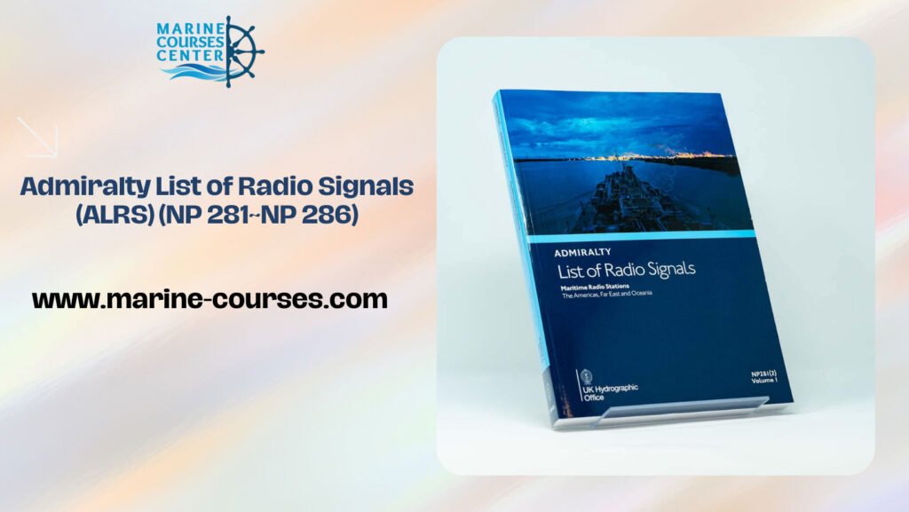
The Admiralty List of Radio Signals (ALRS) is a publication that provides essential information to support maritime communications, navigation, and safety. It is used by ships and shore-based stations to transmit and receive radio communications, and contains a wealth of information about radio frequencies, procedures, and regulations. The ALRS is divided into six volumes (NP 281~NP 286), each covering a specific geographic region. It is published by the United Kingdom Hydrographic Office (UKHO) and is recognized as the authoritative source of information for radio communications in the maritime industry.
Overview of the Admiralty List of Radio Signals
The Admiralty List of Radio Signals (ALRS) is a publication series that provides important information for marine radio communications. The ALRS is published by the United Kingdom Hydrographic Office (UKHO) and contains six volumes, NP 281 to NP 286.
The ALRS covers a wide range of radio communication topics, including radio stations and communication procedures, frequencies and channels, and equipment requirements. It also includes information on distress and safety communications, meteorological broadcasts, and maritime safety information.
The ALRS is an essential tool for anyone involved in maritime radio communications, including ship’s crews, shore-based operators, and maritime authorities. The information in the ALRS helps ensure safe and efficient communication between ships and shore, and can also help prevent maritime accidents and emergencies.
The ALRS is updated regularly to reflect changes in radio communication technology and procedures, as well as changes to regulatory requirements. The UKHO works closely with international organizations, such as the International Maritime Organization (IMO), to ensure that the ALRS provides the most up-to-date and accurate information possible.
Volume 1: Coast Radio Stations
Part 1: Europe, Africa, and Asia
Radio has been a significant tool for communication across the world, particularly for seafarers. Coast radio stations provide an essential service for sailors by broadcasting navigational warnings, weather updates, and other critical information. With the vast expanse of the world’s oceans, there are numerous coast radio stations scattered around the globe. In this article, we will explore some of the most prominent coast radio stations in Europe, Africa, and Asia.
Introduction
- The significance of coast radio stations for seafarers
- The history of coast radio stations
Europe
- The United Kingdom’s coast radio stations
- The Netherlands’ coast radio stations
- The French coast radio stations
- The German coast radio stations
Africa
- The South African coast radio stations
- The Kenyan coast radio stations
- The Egyptian coast radio stations
Asia
- The Japanese coast radio stations
- The Chinese coast radio stations
- The Indian coast radio stations
- The Russian coast radio stations
Part 2: Oceania, the Americas, and Far East
Coast radio stations have played a crucial role in the safety and navigation of seafarers for many years. In this second part of our article, we will explore some of the most significant coast radio stations in Oceania, the Americas, and the Far East.
Oceania
- The Australian coast radio stations
- The New Zealand coast radio stations
- The Papua New Guinea coast radio stations
The Americas
- The United States coast radio stations
- The Canadian coast radio stations
- The Mexican coast radio stations
Far East
- The South Korean coast radio stations
- The Singaporean coast radio stations
- The Malaysian coast radio stations
- The Indonesian coast radio stations
Conclusion
In conclusion, coast radio stations play a critical role in the safety and navigation of seafarers across the world. They provide essential information and help ensure safe travel across the vast expanse of the world’s oceans. While this article has covered some of the most prominent coast radio stations across the globe, there are many more that serve a crucial purpose.
FAQs
- What is the primary purpose of coast radio stations?
- The primary purpose of coast radio stations is to provide seafarers with critical navigational information, including weather updates, navigational warnings, and distress signals.
- How do coast radio stations communicate with ships at sea?
- Coast radio stations typically communicate with ships at sea using high-frequency radio waves.
- Are coast radio stations still relevant in the age of modern technology?
- Yes, coast radio stations are still relevant as they provide a reliable means of communication in case of emergencies, especially in areas with limited network coverage.
- How do seafarers access the information provided by coast radio stations?
- Seafarers can access the information provided by coast radio stations by tuning their radios to the correct frequency and listening to the broadcasts.
- What is the history of coast radio stations?
- Coast radio stations have been in existence since the early 1900s, providing seafarers with critical navigational information to help ensure safe travel across the world’s oceans.
Volume 2: Radio Aids to Navigation, Satellite Navigation Systems, Legal Time, Radio Time Signal, and Electronic Position Fixing Systems (NP 282)
In today’s world, navigation has become an essential part of our lives, especially for those who work at sea. Navigation helps sailors to locate their position and chart a course to their destination, and with the advancements in technology, navigation has become easier than ever before. This article will explore the different radio aids to navigation, satellite navigation systems, legal time, radio time signal, and electronic position fixing systems mentioned in NP 282.
Introduction to Navigation
Navigation is the art of steering a ship or boat from one point to another. Navigation is an essential part of seamanship, and it is necessary for sailors to have a good understanding of navigation techniques. Navigation techniques have evolved over the years, and sailors now have access to advanced navigation equipment that makes navigation easier and safer.
Radio Aids to Navigation
Radio aids to navigation are radio signals transmitted from fixed stations that provide navigational information to vessels at sea. There are different types of radio aids to navigation, such as radio beacons, radio direction finders, and radar beacons. Radio beacons transmit radio signals that can be used to determine a ship’s position, while radio direction finders are used to determine the direction of the signal.
Satellite Navigation Systems
Satellite navigation systems are navigation systems that use satellite signals to determine a ship’s position. These systems are highly accurate and reliable, and they have become the preferred navigation system for many sailors. The Global Positioning System (GPS) is the most well-known satellite navigation system, and it is used by ships all over the world.
Legal Time
Legal time is the time that is used as the standard time in a country. It is the time that is used to regulate activities such as air traffic, shipping, and international trade. The legal time is determined by the local government, and it is usually based on the time at the capital city.
Radio Time Signal
Radio time signals are signals transmitted by radio stations that provide accurate time information. These signals are used by ships to set their clocks and ensure that they are operating on the correct time. The most well-known radio time signal is the Greenwich Mean Time (GMT) signal.
Electronic Position Fixing Systems
Electronic position fixing systems are systems that use electronic equipment to determine a ship’s position. These systems are highly accurate and can provide a ship’s position within a few meters. Electronic position fixing systems are essential for navigating in areas with restricted visibility, such as in fog or heavy rain.
Conclusion
In conclusion, navigation is an essential part of seamanship, and with the advancements in technology, navigation has become easier and safer. Radio aids to navigation, satellite navigation systems, legal time, radio time signal, and electronic position fixing systems are all important tools that sailors use to navigate safely. It is important for sailors to have a good understanding of these tools and to use them properly.
FAQs
- What is the difference between radio beacons and radio direction finders?
- Radio beacons transmit radio signals that can be used to determine a ship’s position, while radio direction finders are used to determine the direction of the signal.
- What is the most well-known satellite navigation system?
- The most well-known satellite navigation system is the Global Positioning System (GPS).
- What is legal time?
- Legal time is the time that is used as the standard time in a country.
- What is the most well-known radio time signal?
- The most well-known radio time signal is the Greenwich Mean Time (GMT) signal.
Maritime Safety Information Services (NP 283-1&NP 283-2) – Providing Vital Information for Safe Navigation
Maritime safety is crucial for shipping vessels and sailors around the world. To ensure safe navigation, vessels need up-to-date information on weather, navigational warnings, and other relevant data. This is where the Maritime Safety Information Services (NP 283-1&NP 283-2) come into play. NP 283-1 covers Europe, Africa, and Asia, while NP 283-2 covers Oceania, the Americas, and the Far East. Both volumes provide important details on radio facsimile broadcasts, navigational warnings, weather services, and other related services that enable safe navigation.
In this article, we will delve into the details of the Maritime Safety Information Services (NP 283-1&NP 283-2), exploring the different types of information provided and how they can benefit sailors and shipping vessels.
Understanding Maritime Safety Information Services
Maritime Safety Information Services (MSIS) is a vital aspect of safe navigation for ships and vessels at sea. It provides valuable information related to navigation, weather, and other important aspects of marine safety.
There are several different types of MSIS available to mariners. Some of the most common types include radio facsimile broadcasts, radio weather services, radio navigational warnings (including NAVTEX and WWNWS), GUNFACTS and SUBFACTS broadcasts, weather routing services, global marine meteorological services, and certain meteorological codes provided for use in shipping.
Each type of MSIS provides valuable information to mariners that can help them make informed decisions while navigating at sea. For example, radio weather services can provide up-to-date weather forecasts, while navigational warnings can alert mariners to hazards such as rocks or shoals. Additionally, weather routing services can help mariners plan the safest and most efficient route for their journey based on weather conditions and other factors.
Overall, MSIS is an important tool for ensuring the safety of vessels at sea, and it is crucial that mariners are aware of and make use of the various types of MSIS available to them.
Navigational Warnings
Navigational warnings are a type of maritime safety information service that provides information to mariners about potential hazards in their intended route. These warnings are issued by coastal authorities or other organizations responsible for maritime safety.
There are several different types of navigational warnings. The most common types include NAVTEX (Navigational Telex), which is a system for broadcasting navigational warnings and weather forecasts, and WWNWS (Worldwide Navigational Warning Service), which is a global system for broadcasting navigational warnings.
Navigational warnings can also be issued in the form of notices to mariners, which provide updates on changes to navigational aids or other important information related to navigation. Additionally, some navigational warnings may be issued in the form of local notices to mariners, which provide information specific to a particular region or port.
Overall, navigational warnings are an important aspect of maritime safety and navigation, as they provide mariners with critical information about potential hazards in their intended route. It is essential that mariners are aware of the different types of navigational warnings and how to access them in order to ensure safe navigation at sea.
3.1 What are Navigational Warnings?
Radio weather services are a type of maritime safety information service that provides mariners with up-to-date weather information while they are at sea. These services can provide a range of weather-related information, including current conditions, forecasts, and storm warnings.
There are several different types of radio weather services available to mariners. One common type is the High Seas Weather Broadcast, which provides weather information for the open ocean. Another type is the Coastal Weather Broadcast, which provides weather information for coastal regions.
In addition to these services, there are also specialized weather services available for mariners. For example, some services may provide information on tropical storms or hurricanes, while others may provide information on ice conditions in colder regions.
Overall, radio weather services are a crucial aspect of maritime safety, as they provide mariners with essential information about weather conditions that can impact their vessel and crew. It is important for mariners to make use of these services and stay up-to-date with the latest weather information in order to ensure safe navigation at sea.
3.3 How are Navigational Warnings transmitted?
Radio Weather Services
Radio weather services are a type of maritime safety information service that provides mariners with up-to-date weather information while they are at sea. These services can provide a range of weather-related information, including current conditions, forecasts, and storm warnings.
There are several different types of radio weather services available to mariners. One common type is the High Seas Weather Broadcast, which provides weather information for the open ocean. Another type is the Coastal Weather Broadcast, which provides weather information for coastal regions.
In addition to these services, there are also specialized weather services available for mariners. For example, some services may provide information on tropical storms or hurricanes, while others may provide information on ice conditions in colder regions.
Overall, radio weather services are a crucial aspect of maritime safety, as they provide mariners with essential information about weather conditions that can impact their vessel and crew. It is important for mariners to make use of these services and stay up-to-date with the latest weather information in order to ensure safe navigation at sea.
You must be logged in to post a comment.