Admiralty Sailing Directions (NP 1 – NP 72): The Comprehensive Guide to Ocean Navigation
Admiralty Sailing Directions (NP 1 – NP 72): The Comprehensive Guide to Ocean Navigation

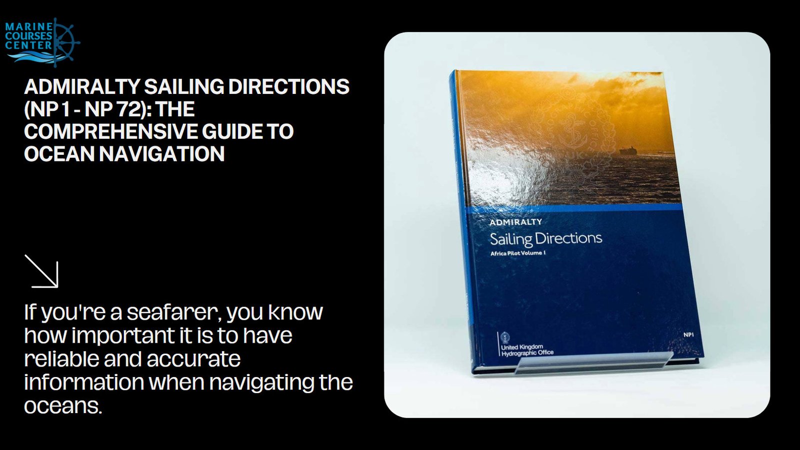
If you’re a seafarer, you know how important it is to have reliable and accurate information when navigating the oceans. One of the most comprehensive sources of such information is the Admiralty Sailing Directions, also known as Pilots Books. This series of 74 volumes provides worldwide coverage for vessels over 12 meters in length. In this article, we’ll take a closer look at what these sailing directions are, their purpose, and the information they contain
What are Admiralty Sailing Directions?
Admiralty Sailing Directions are a series of publications created by the UK Hydrographic Office to provide mariners with the most up-to-date information on navigating the world’s oceans. They cover all aspects of navigation, from buoyage systems to pilotage, port entry, and more. The series is designed to be used in conjunction with nautical charts and other navigational publications.
Purpose of Admiralty Sailing Directions
The primary purpose of Admiralty Sailing Directions is to assist mariners on all classes of ocean-going vessels. They provide essential information to help navigate safely and efficiently. The information contained in these volumes is continually updated to ensure that it reflects the latest changes and developments.
What Information is Contained in Admiralty Sailing Directions?
Admiralty Sailing Directions contain a wealth of information that is critical to safe navigation. Here’s a breakdown of what you can expect to find in these volumes:
Navigation Hazards
One of the most important pieces of information contained in Admiralty Sailing Directions is the identification of navigation hazards. This includes everything from submerged rocks and reefs to shallow areas and wrecks.
Buoyage Systems
Another critical aspect of ocean navigation is understanding the various buoyage systems used around the world. Admiralty Sailing Directions provide detailed information on buoyage systems, including the meaning of different buoys and markers, as well as their colors and shapes.
Regulations
Navigating the world’s oceans can be a complex and challenging task. Admiralty Sailing Directions provide essential information on regulations, including international laws and regulations, as well as local regulations for specific countries and regions.
General Notes on Countries
Navigating unfamiliar waters can be a daunting task, but Admiralty Sailing Directions provide valuable information on the countries and regions that mariners may encounter. This includes everything from cultural information to local customs and traditions.
Pilotage
Admiralty Sailing Directions also provide information on pilotage, including the availability of pilots in different regions and the procedures for obtaining their services.
Port Entry
Navigating into and out of ports can be a challenging task, but Admiralty Sailing Directions provide detailed information on port entry, including the location of the port, the available facilities, and any navigational hazards that must be avoided.
Port Facilities
In addition to port entry, Admiralty Sailing Directions also provide information on the facilities available in different ports. This includes everything from available mooring facilities to fuel and water supplies.
Meteorological Data
Admiralty Sailing Directions provide information on the meteorological conditions that seafarers may encounter during their voyages. This includes information on weather patterns, sea conditions, and other factors that may affect navigation.
Seasonal Currents
Admiralty Sailing Directions provide information on the seasonal currents that seafarers may encounter during their voyages. This includes information on the direction and strength of currents, as well as the best times of year for navigating different waterways.
- Navigation Hazards: These directions provide comprehensive information on navigation hazards such as submerged rocks, sandbanks, reefs, and other obstructions to safe navigation. They also provide information on the location and characteristics of navigational aids such as buoys, beacons, and lighthouses.
- Buoyage Systems: The sailing directions contain detailed information on the different buoyage systems used around the world. This information is critical for safe navigation, especially in unfamiliar waters.
- Regulations: These directions provide information on the regulations and laws that apply to navigation in different regions around the world. This includes information on maritime safety regulations, customs and immigration requirements, and other relevant laws and regulations.
- General Notes on Countries: The sailing directions contain a wealth of information on the countries and regions covered in the series. This information includes general background information, history, culture, and other useful information for mariners.
- Pilotage: The directions contain information on pilotage requirements and procedures in different ports and waterways around the world. This information is critical for safe navigation in areas where local knowledge is essential.
- Port Entry: These directions provide information on the entrance to different ports, including information on pilotage, tides, currents, and other factors that may affect safe navigation.
- Port Facilities: The sailing directions contain information on the facilities available in different ports, including information on berths, moorings, and other essential facilities for ships.
- Meteorological Data: These directions provide detailed information on weather patterns and meteorological conditions in different regions around the world. This information is essential for mariners to plan safe and efficient voyages.
- Seasonal Currents: The sailing directions contain information on the seasonal currents that affect navigation in different regions around the world. This information is critical for mariners to plan safe and efficient voyages.
- Ice and Climatic Conditions: These directions provide information on ice and climatic conditions in different regions around the world. This information is essential for mariners to plan safe and efficient voyages, especially in areas where extreme weather conditions may be encountered.
- Coastline Descriptions: The sailing directions contain detailed descriptions of the coastlines of different regions around the world. This information is critical for mariners to plan safe and efficient voyages, especially in areas where navigational hazards are present.
Complement to Charts and Other Navigational Publications
Admiralty Sailing Directions are designed to complement charts and other navigational publications. The information contained in these directions is intended to be used in conjunction with other navigational tools to provide a comprehensive picture of the conditions and hazards that mariners may encounter on their voyages.
Conclusion
Admiralty Sailing Directions are an essential resource for mariners navigating the oceans of the world. These comprehensive guides provide essential information on all aspects of navigation, including navigation hazards, buoyage systems, regulations, general notes on countries, pilotage, port entry, port facilities, meteorological data, seasonal currents, ice and climatic conditions, and coastline descriptions. By providing mariners with the information they need to navigate safely and efficiently, these sailing directions play a critical role in ensuring the safety and security of maritime navigation around the world.


